 Top rated - North Carolina
|

Lower Dismal Falls2402 viewsI should not go here but, I did.
(1 votes)
|
|

Middle Falls ***2469 viewsThe middle falls on Flat Laurel Creek is a *** because of the descent and ascent from the trail. Done worse but, it can be tricky.
(1 votes)
|
|

Fall Colors2408 viewsFall colors can be seen up on top of the falls. With a little assist from the Roaming Knob the laurels parted for this photo.
(1 votes)
|
|

Big Falls2434 viewsMount Hardy Falls is measured at over 100 ft and even though it was a dry spell still had pretty good water.
This is a MST trail falls and is not hard to get to but, has some laurels and of course slick rocks.
(1 votes)
|
|

Big Falls2352 viewsMount Hardy Falls is measured at over 100 ft and even though it was a dry spell still had pretty good water.
This is a MST trail falls and is not hard to get to but, has some laurels and of course slick rocks.
(1 votes)
|
|
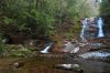
Makes up for the Laurls.2277 viewsI should know better than hike with Tom, ends up the same way, in the laurels and slick rocks.
Was it worth it, laurels, bogs, slick rocks? You bet.
(1 votes)
|
|

Lower Bubbling Springs Falls2310 viewsNever get enough of seeing a falls new to me. As I get older the rocks get further apart and even more slick.
If I get much older I will not be able to see the next rock.
(1 votes)
|
|

Upper Bubbling Springs Falls 22421 viewsJust another view of upper falls.
(1 votes)
|
|

Upper Bubbling Spring Falls2343 viewsNot a long hike from NC-218 but, if you don't like Laurel bushes and rock hopping stay on the road.
(1 votes)
|
|

Dill Falls2401 viewsI give Dill Falls a ** because of the final 0.1 miles down to the base of the falls. Very steepbut, with trees and laurel to hold on to. Coming back up that slope, best way you can.
When you come down the forest road proceed past the "y"where NF 4663B and NF 4663A fork, stay on the left fork or 4663B, until you reach N35.28349. W082.94353. On your left you should see a trail with a "jeep trap".
Take that trail until it runs out, about 0.3 miles, then veer slightly to your left and follow the falls soun
(1 votes)
|
|

The Veil2404 viewsIt spreads out like a BRIDAL VEIL as it flows down the slide type rock face.
(1 votes)
|
|
Left Side2381 viewsThis is the side one would normally use to reach the cave. Walk on dry rock only,VERY SLICK.
(1 votes)
|
|
| 133 files on 12 page(s) |
 |
|
4 | |
|
|
|
|
|
|
|

 Home
Home Login
Login Album list
 Last uploads
 Last comments
 Most viewed
 My Favorites
 Search
